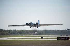
The RC-10 Mapping Camera was an airborne imaging system built by Wild Heerburg. It was a metric mapping camera with a shutter intervalometer for capturing stereo imagery. It operated across the 510 to 900 nm spectral range and had a typical resolution of 1.5 to 4 meters. The camera featured a 9x9 image format and was mounted in the Q-bay, nose pod, and both left and right wing pods of NASA’s ER-2 aircraft.

Instrument Details
- Optical/Photon
- Earth Science > Spectral/engineering > Visible Wavelengths > Visible ImageryEarth Science > Spectral/engineering > Infrared Wavelengths > Infrared Imagery
- Land Surface
- N/A
- 1.5-4 m
- 333.1-587.8 THz
- Currently unavailable
James Jacobson Jr.
James Jacobson Jr.
Wild Heerburg
Currently unavailable
Currently unavailable
Unpublished
Filter data products from this instrument by specific campaigns, platforms, or formats.
CAMPAIGNS
PLATFORMS

